Exploring OpenStreetMap’s potential as a cycling infrastructure database
ECF examines how OpenStreetMap can help us learn about cycling infrastructure from around the world, providing a brief introduction to the database and an overview of existing cycling projects based on OSM data.
The possibility to observe and cross-analyse cycling infrastructure from different countries would be a huge benefit to understand and improve cycling conditions on an international scale. But in order to compare the state of cycling infrastructure across different levels of governance, there is a need for more open data.
Existing methods, such as in-person audits and various types of high-tech sensors, are rather laborious, resource-intensive and bound to a specific place and time. Hence, the data comparability falls short on a European scale. However, the solution to getting the data we need may already be out there: OpenStreetMap (OSM).
The Wikipedia of Maps
More and more actors are considering OpenStreetMap – also known as “the Wikipedia of maps” – as an alternative to commercial or authoritative data. OSM was founded in 2004 in the United Kingdom with the mission to create a free, editable, world-wide geographic dataset. Theoretically speaking, anyone can add, edit and extract OSM data, and many different users do so, including route planners, local authorities, and researchers. The reliance on volunteers for user contributions, however, also brings about OSM first limitation: there is no quality control in place. Hence, despite thorough tagging guidelines, the data is not always the most consistent.
The taxonomy of cycling infrastructure – such as what is understood to be a cycle track versus a cycle lane – may vary based on the local context. While the challenge of ensuring consistent definitions for cycling infrastructure may go beyond OSM, the mapping community is making great efforts to standardize their tagging procedures, possibly making OSM the most comparable data source to date on an international scale.
Naturally, not every corner of the world is mapped with the same level of accuracy, but generally, urban areas in Europe are mapped with a great amount of detail. In fact, in some areas, OSM data has been found to be more complete, precise and up-to-date than data from local authorities; for example, in OSM, cycle tracks may include tags about the surface material or lane width. It is precisely this rich, open data that makes up OSM's potential for the advancement of cycling-related research and advocacy work.
In the ideal scenario, governmental data and OSM data would be better aligned and integrated – something that is already taking place in certain cities. The City of Warsaw, Poland provides cycling infrastructure data to OpenStreetMap; while the migration of possibly the largest urban cycling data collection project to date – Transport for London’s Cycling Infrastructure Database (visualized by CycleStreets) – to OSM is also currently ongoing.
How can OSM data be used?
A number of projects use OpenStreetMap to evaluate bicycle networks. For example, the Bicycle Network Analysis (BNA) by PeopleForBikes measures how well a city’s bicycle network connects people to the places they want to go via low-stress connections. The network is constructed based on OSM data and other public data sources, and default assumptions are applied in the case of missing data. BNA’s scoring system has been used to identify gaps in the existing network, to decide where to allocate funding and to make comparisons over time and across space.
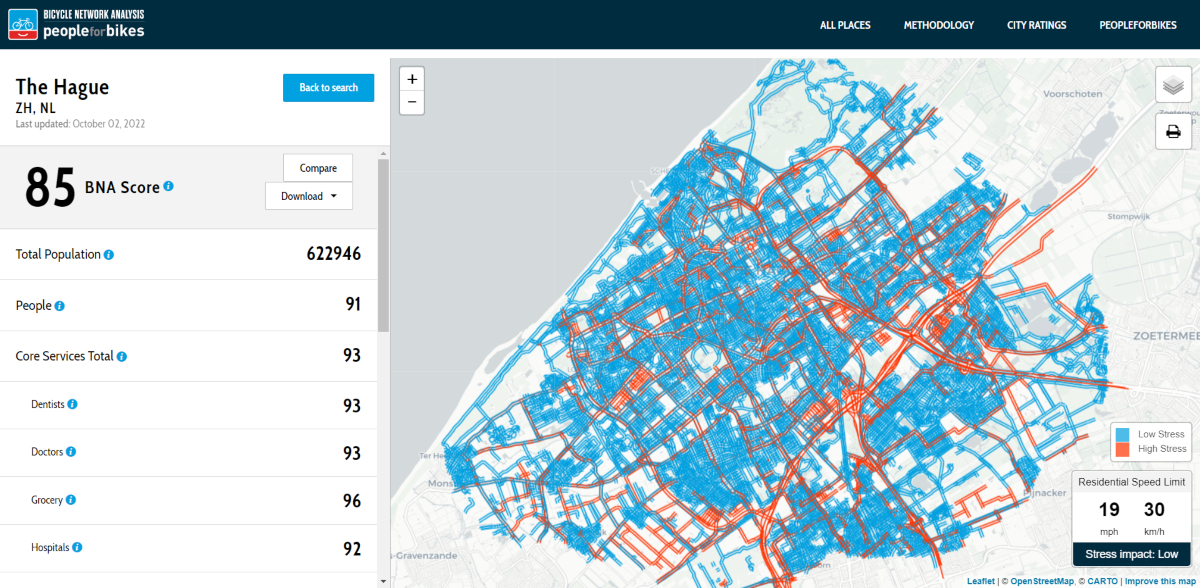
Screenshot showing BNA map, including city score for connectivity (Source: bna.peopleforbikes.org)
CycloRank makes a much simpler comparison of cycling infrastructure to the total length of road network. The interesting addition is weighting of infrastructure dependent on the distance from centre, with the assumption that cycling provisions in the centre are more valuable than in the outskirts.
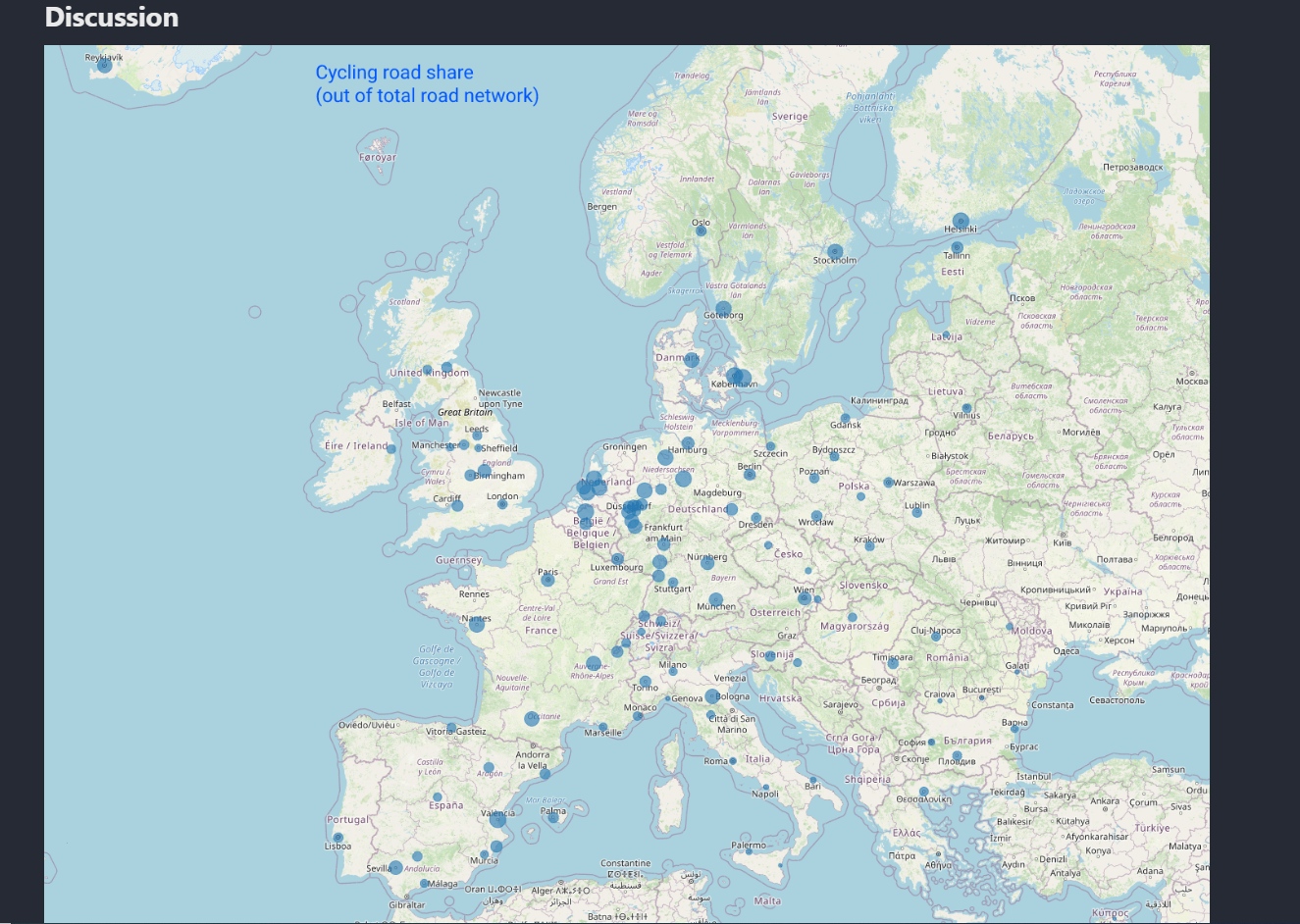
Screenshot of CycloRank map of compared cities (Source: mlumiste.com/projects/cyclorank)
CicloMapa by the Brazil Cyclists Union (UCB) and the Institute for Transport and Development Policy (ITDP Brasil) is an open platform that aims to increase the visibility of cycling infrastructure (or lack thereof) in Brazilian cities, in order to influence public policy. The user-friendly platform visualizes OSM cycling data and relevant statistics and is directly integrated with the OSM editing software. To complement the tool, they also created several tutorials in Portuguese on OSM editing, collaborative mapping and field surveys.
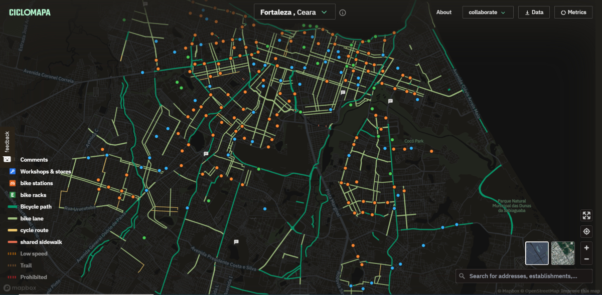
Screenshot showing CicloMapa map (Source: ciclomapa.org.br)
Another project that also features a direct integration with the OSM editing software is CycloFix. This project emerged during a summer coding program and received funding from the regional government, with the goal to map, display and integrate cycling infrastructure and relevant points of interest in the Brussels-Capital Region, a place known for its high levels of bureaucracy and political fragmentation. Via the mapping tool MapComplete, every user – regardless of their technical background – can add data directly into OpenStreetMap.
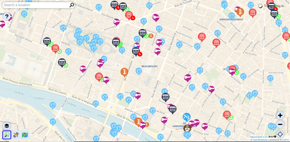
Screenshot of CycloFix map, including information of cycling facilities (Source: cyclofix.osm.be/map/)
GrowBike by Associate Professor Michael Szell and colleagues at ITU Copenhagen (2021) is an interactive data visualization platform that explores how to grow a cohesive bicycle network from scratch in 62 cities worldwide. The platform also allows you to compare the synthetically grown networks with your existing bicycle network, which tend to be highly fragmented. Importantly, it is small but focused investments that can connect a bicycle network effectively; it’s not about the length, but about how you grow it.
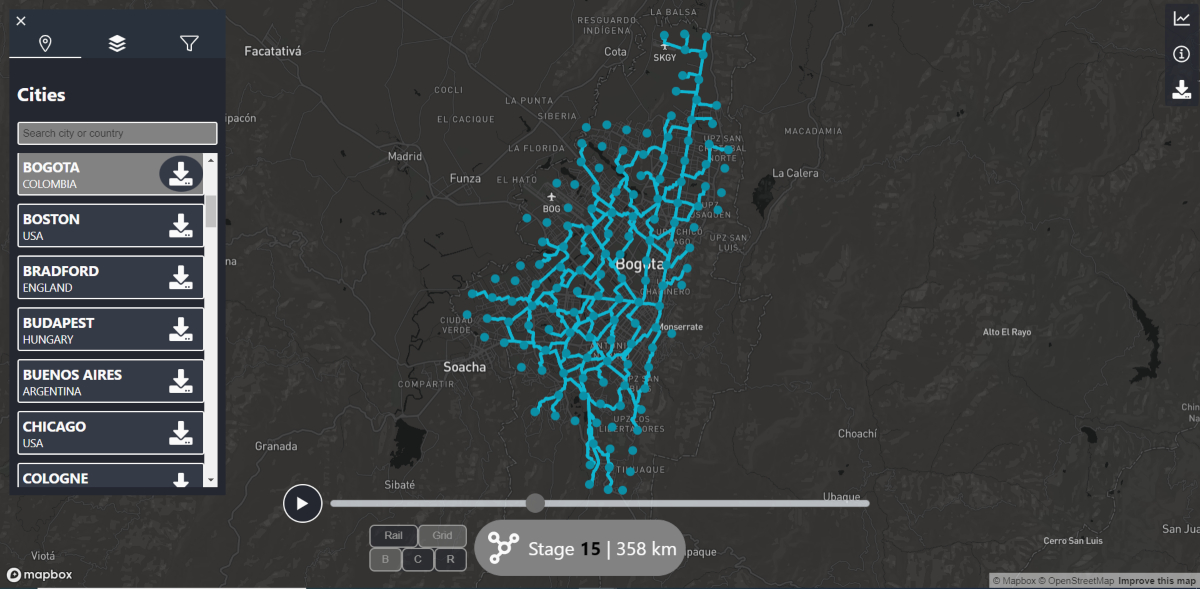
Screenshot of GrowBike map, showing the different stages of network growth (Source: growbike.net)
ECF thanks the OpenStreetMap community for their contributions. If you know of any other cycling data-related projects based on OpenStreetMap data, feel free to contact ECF.
Regions:
News category:
Contact the author
Recent news!
Upcoming events
Contact Us
Avenue des Arts, 7-8
Postal address: Rue de la Charité, 22
1210 Brussels, Belgium

