#VC19DublinCase: Improving cyclist safety by visualizing the built environment
Author: Dublin City Council
This research is being conducted by the Technological University of Dublin and Trinity College Dublin using funding from the Road Safety Authority.
Dublin city is an ancient city, consisting of narrow streets. The challenge is to provide a network that is safe, accessible and desirable for all levels of cyclists. In Dublin, over the past decade cycling as a mode of transport has become increasingly popular. According to the canal cordon count, cyclist numbers crossing into the city at peak times have increased by 157% between 2006 and 2017. Over the same period, according to Road Safety Authority (RSA) figures cyclist related collisions have also increased.
Niamh O’Reilly, the lead researcher from the Technological University of Dublin, states that “the research aims to develop a framework to reduce the number of cyclist collisions and improve road safety through identification and evaluation of areas with a high incidence of cyclist collisions from which preventative measures as adopted internationally will be proposed specifically to reduce risk of collisions.”
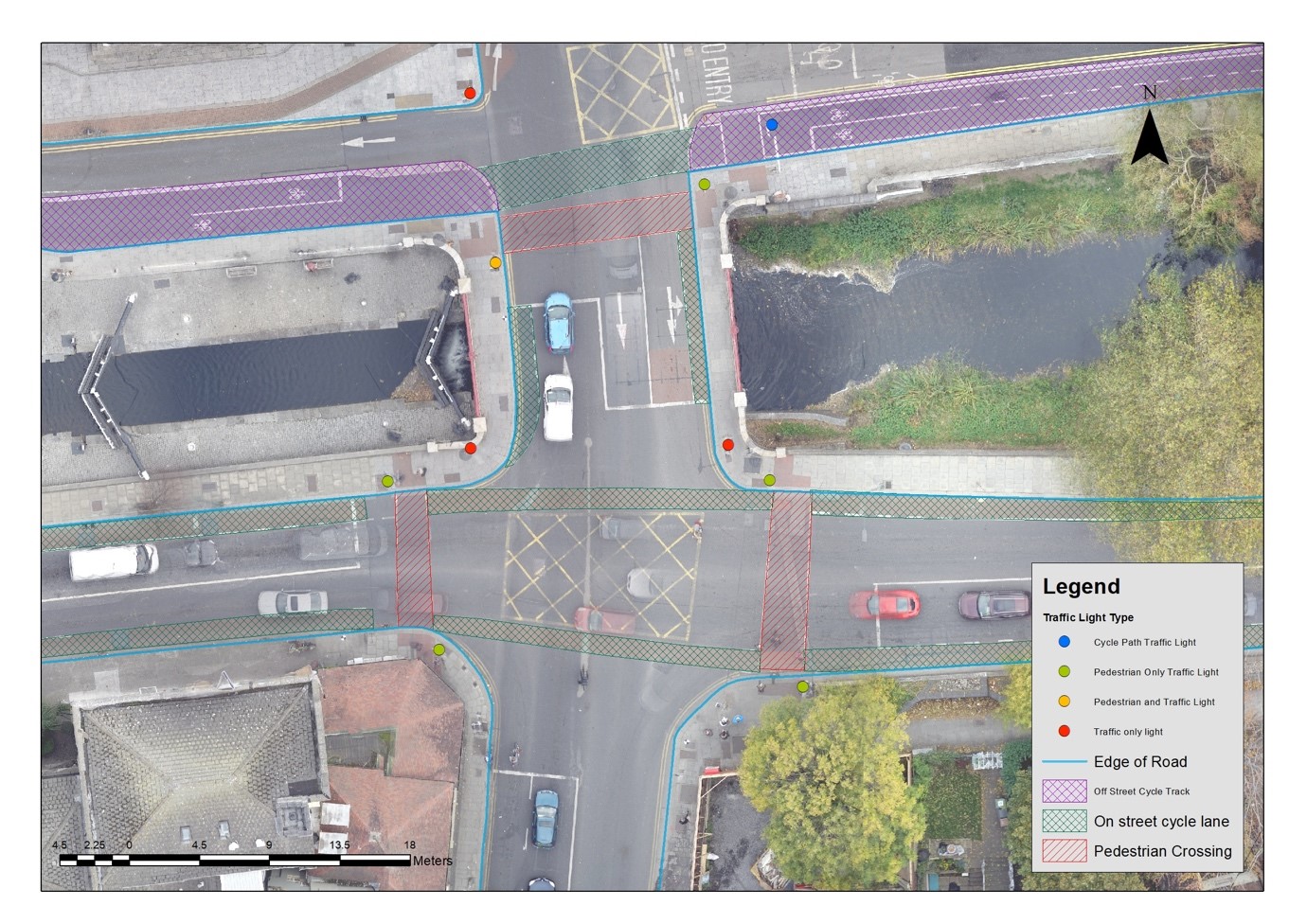
Understanding the nature of where and when cyclist collisions occur is crucial to identifying interventions that can be put in place to reduce them in the future. Using collision data provided by RSA, together with a number of other spatial datasets including road and cycle infrastructure, the temporal spatial location of cyclist related collisions that had occurred in Dublin between the years of 2006 and 2012 were analysed in a GIS using a kernel density method. The results from this analysis identified a number of hot spot areas, in particular at junctions around the city where higher numbers of collisions had occurred.

Although this part of the analysis provided much better insight into the collisions, a more in-depth study was undertaken to determine if other spatial factors not apparent could attribute to these collisions.
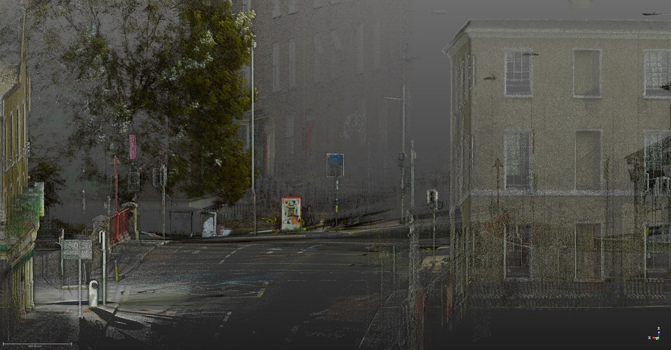
Possible applications of the research include recreating cyclist collisions in a virtual reality environment, creating multiple run through scenarios. The model can potentially be used to assess visibility for all road users, junction control and street furniture layout.
Identification of reliable collision hot spot areas based on a number of spatial variables and an assessment of these collisions over time to determine if changes to the road and cycle network together with other preventative measures have resulted in reduction of cyclist collisions.
A more in-depth examination of collision hot spot areas will be undertaken to identify any other spatial variables or conditions such as visibility at junctions that may be a contributing factor in collisions. This will be done using the latest state of the art survey technology such as mobile mapping to collect the point data required to create the 3D model. The methodology used to produce this 3D model can be used for further similar studies.
Associate Professor Brian Caulfield, a member of the research team from Trinity College, argues that “these improved visualisation tools will enable researchers and accident investigators improve our understanding of cyclist accidents and ultimately save lives.”

Regions:
News category:
Network/Project Involved:
Contact the author
Recent news!
Upcoming events
Contact Us
Avenue des Arts, 7-8
Postal address: Rue de la Charité, 22
1210 Brussels, Belgium


