“Integrated Cycling Planning Guide”: An EU CYCLE tool for building regional cycle networks
31 Jan, 2022
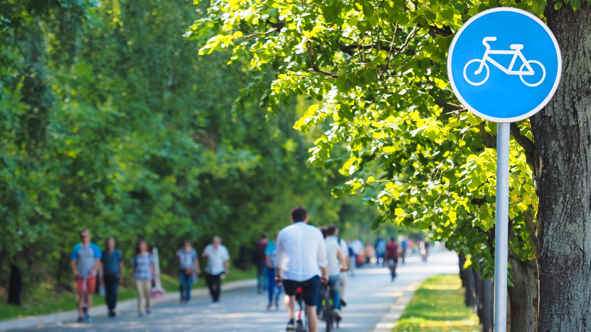
Building an entire cycle network is usually tackled in sections. By prioritising investment using different strategies to target low-hanging fruit and maximum return, planners can ensure that the network development builds the momentum it needs.
How do you go about creating a regional cycle network? While it is not always possible to build an entire network all at once, making the right choices for the initial sections can be crucial in creating momentum for further upgrades and extensions to the network.
Ensuring that the first sections of a new network maximise the number of users that can already begin to use the route will, in turn, reinforce demand for cycling. Celebrating progress, for example with photo opportunities when opening subsequent stages, can be an important element to gather political support. On the other hand, if the first sections lead nowhere, are disconnected or are difficult to reach, the resulting lack of users can discourage the continuation of the effort.
In the EU CYCLE project’s new “Integrated Cycling Planning Guide,” we compare three main prioritisation strategies for cycle networks, based on route potential, low-hanging fruit and conditions for cycling. For example, in West Pomerania in Poland, priority corridors for development were defined on the basis of the location of principal touristic traffic generators (potential) and identifying low-hanging fruit (ease of implementation).
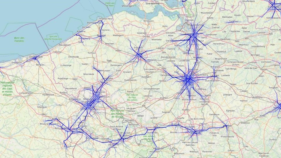
Cycle Highway Potential Map, developed in the frame of the CHIPS project, is a simple EU-level model evaluating the potential for medium-range cycle trips on the basis of the Eurostat demographic data.
Highest potential
Which connections could facilitate the most bicycle trips? For functional networks (as opposed to leisure-focused routes), this can be estimated by selecting from the traffic model trips within cycle commuting distance. The Cycle Highway Potential Map, developed within the scope of the CHIPS (Cycle Highways Innovation for smarter People Transport and Spatial Planning) project provides a rough estimation of potential traffic for all regions of the EU, based on Eurostat demographic data. The results should of course be refined with a more tailored national or regional traffic model, but can at least provide a first orientation as to which areas and corridors merit further analysis.
Touristic routes also have varying potential, depending on the ease of access, main attractions, and attractiveness of the route itself. However, as for now, there are no available ready to use tools for quantifying this potential.
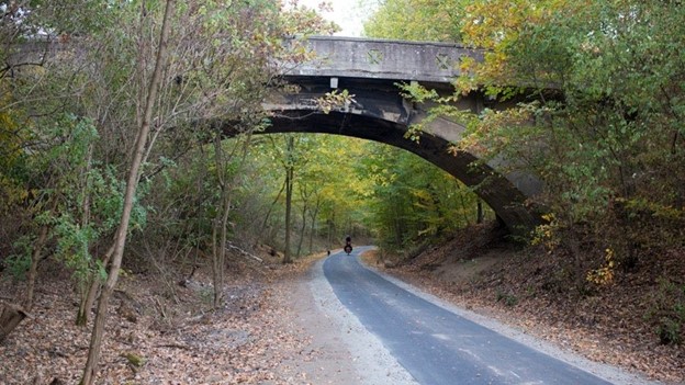
Cycle track on a disused railway in Western Pomerania, Poland. Photo credit: Wanda Nowotarska.
Low-hanging fruit
Certain corridors offer very low-hanging fruit. Disused railroad lines, levees along rivers, towpaths along canals – all of these provide a possibility to build a high-quality greenway (a route specifically for walking, cycling and other non-motorised traffic, independent of the road network) quickly and cheaply. The advantages include:
-
Natural separation from the road network.
-
Flat route, without any steep gradients.
-
Long stretches with single land ownership, often state-owned – no need to negotiate with hundreds of individual landowners.
-
Attractive surroundings – levees and railway embankments provide a view over surrounding areas whilst rivers and canals are attractive in of themselves. Railway engineering structures (bridges, tunnels) can serve as an attraction as well.
These corridors can form a very good starting point for a regional network, as witnessed in Wallonia, Belgium or Małopolska, Poland. However, additional investments might be necessary to connect loose ends and rectify any missing links. Unfortunately, it is very unlikely that an entire network can be built from greenways only.
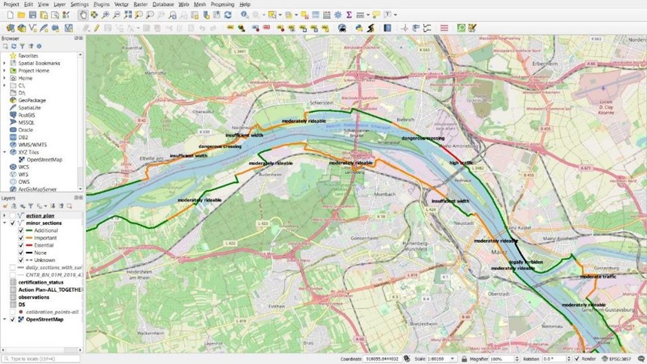
Example assessment of the EuroVelo 15 route. Different colours show the level of compliance with the European Certification Standard, for example, orange sections meet the Essential and Important criteria, but not the Additional. Black sections – not meeting any criteria level – are the highest priority to address.
Aiming for maximum improvement in conditions for cycling.
Network or route development can also prioritise sections that currently provide the worst conditions for cycling (for example caused by heavy traffic, poor road surface quality or extreme gradients). This approach ensures that part of the target users previously unlikely to utilise routes with poor cycling conditions can start using the route after the initial stages of development and reinforce demand for further upgrading the route.
The EuroVelo European Certification Standard, a methodology developed by ECF to assess cycling routes, provides a tried and tested method to assess which sections of a route need an intervention most urgently, by dividing the criteria into three levels: Essential, Important and Additional, thereby addressing the needs of cyclists with different level of fitness, skill and experience.
News category:
Related content

ECF at COP29 | Baku, Azerbaijan | 11-22 November 2024
ECF will actively participate once again at COP29 as a UN-accredited observer NGO, as well as a core partner of the Partnership for Active Travel and Health (PATH), and a long-time member of the Partnership for Sustainable Low Carbon Transport (...
Froso Christofides
14 Nov, 2024

ECF at the World Urban Forum 12 | 4-8 November | Cairo, Egypt
Authored by Jill Warren and Froso Christofides ECF goes to WUF12 to advocate for cycling’s potential to help meet climate goals and improve people’s health and lives The twelfth session of the World Urban Forum by UN-Habitat took place on 4-8...
Jill Warren
12 Nov, 2024

Neringa Municipality – Merging Natural Beauty, World Heritage and Cycling Ambition
ECF welcomes Neringa Municipality to Cities & Regions for Cyclists, a network that brings together local and regional administrations committed to promoting cycling as a mode of transport and leisure, collectively representing...
Froso Christofides
12 Nov, 2024
Contact the author

Recent news!


Upcoming events
Contact Us
Avenue des Arts, 7-8
Postal address: Rue de la Charité, 22
1210 Brussels, Belgium
Phone: +32 2 329 03 80
Email: office@ecf.com